 日本語
日本語 English
 简体中国
简体中国 한국
한국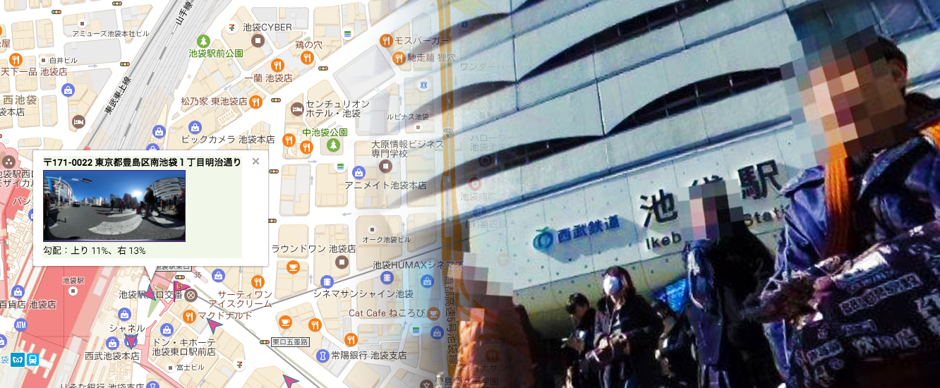
Fiscal 2016 Social Welfare Promotion Promotion Project
(Welfare and Medical Care Agency of Independent Administrative Institution)
As part of the Fiscal Social Welfare Promotion Promotion Support Program of the Welfare and Medical Service Organization of the independent administrative institution, we have started to produce a traffic support map for handicapped people to inform the disabled people of the road conditions in detail and survey of the road condition accompanying it.
We embedded information on road conditions such as slope, presence of steps, degree, etc. on the map. Omnidirectional photographs of essential points are posted so you can check the extent of the slope and steps with your own eyes, and you can also view information such as notes. To use, please search the place in the same way as you see the map on the smartphone. Icons are displayed in the surveyed place. By tapping (clicking) the icon you can view the necessary information.
for people with disabilities
(googleMap linked version)
How to use the traffic support map for people with disabilities
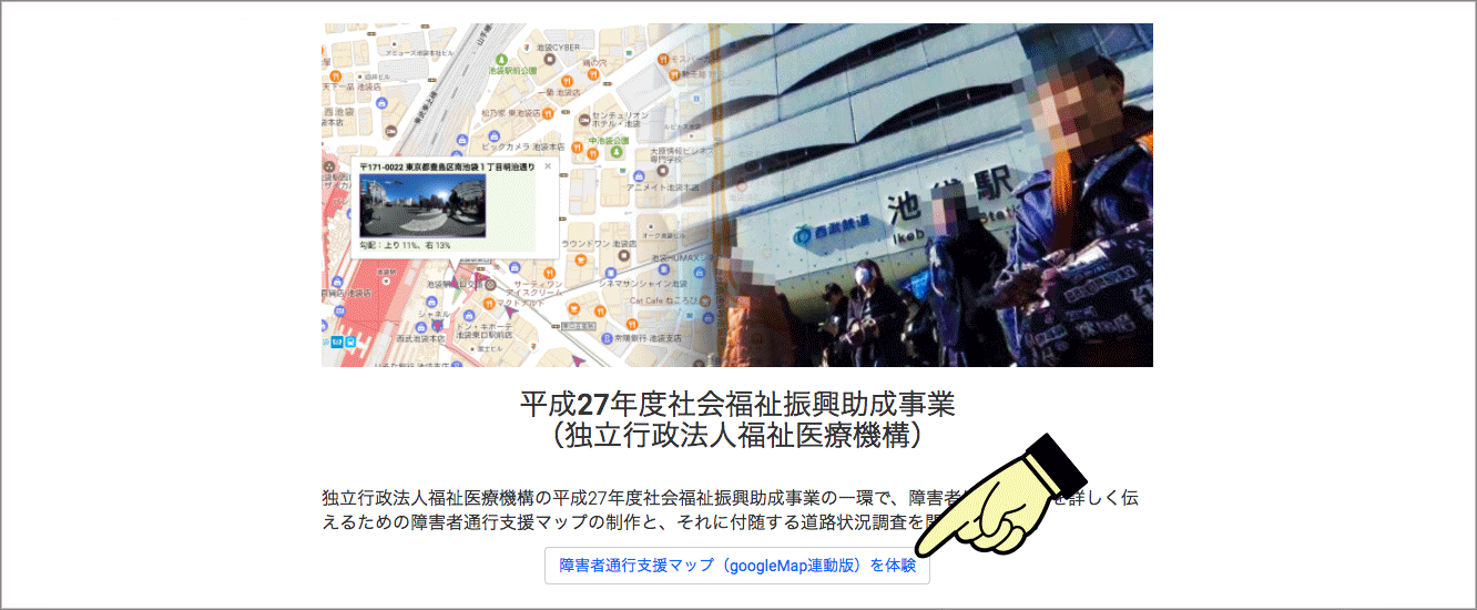
1:Click on "Disability traffic support map (googleMap linked version)" button
Please click the "disabled traffic support map (googleMap linked version)" button at the top of this page.
People with disabilities passage support map is displayed.
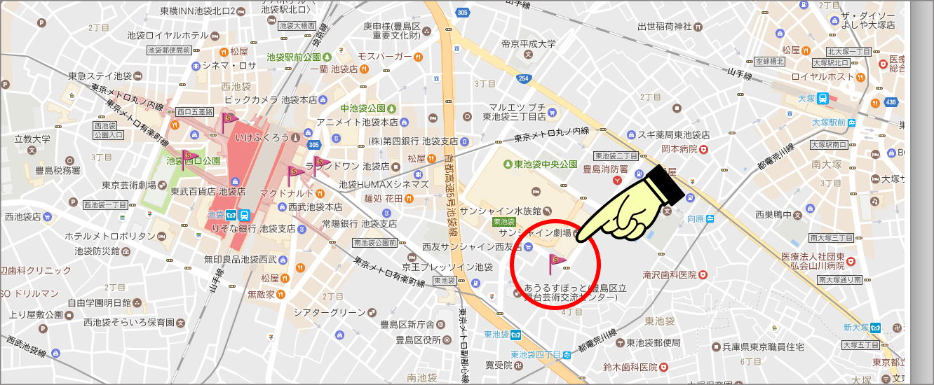
2:Click "Flag icon" on the map
Please click the flag icon on the map.
An arrow icon will appear on the survey route starting from the clicked flag icon.
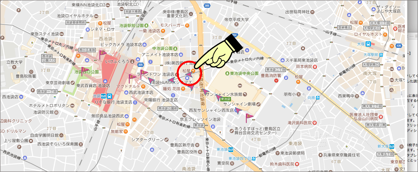
3:Click "arrow icon"
Please click the arrow icon displayed.
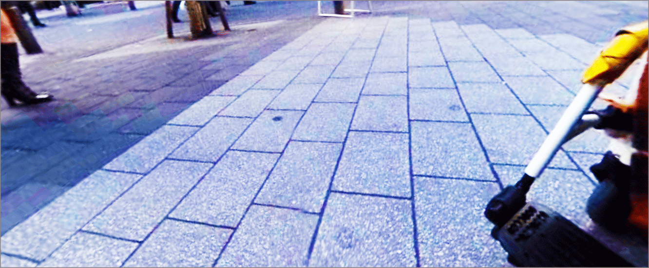
"360 degree image preview" and "slope" measured at the position where the icon exists are displayed.
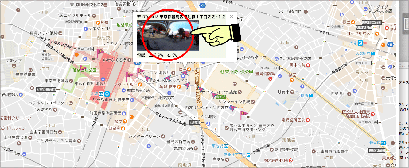
4:Click "360 degree image preview"
Click "360 degree image preview".
A 360 degree image is displayed in a separate window.
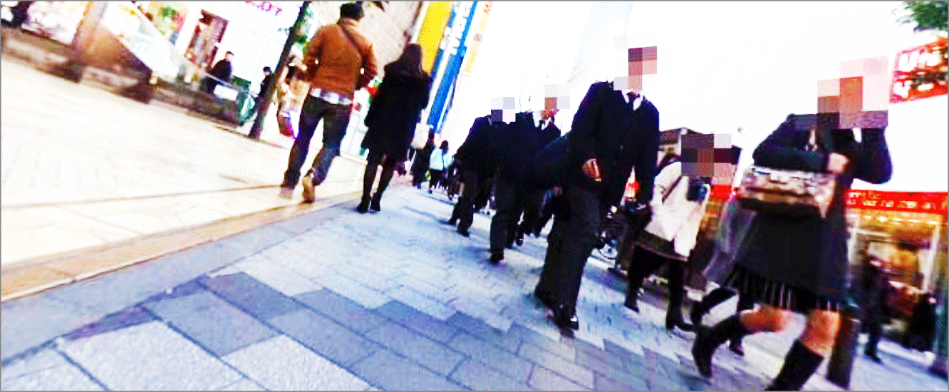
5:Confirm the road surface condition at the measurement point with a 360 degree image
Move your cursor over the 360 degree image and move it left, right, up and down while left clicking.
You can check the condition of the road at the measurement point in the 360 degree image.

6:Avoid dangerous routes for wheelchairs in advance
If you are using a wheelchair, you can check that the wheelchair you are using is a road surface that you can travel without having to go to the site. Please make use of it beforehand in preparation for going out. It is also viewable from smartphones and tablets, so you can check outdoors so you can avoid dangerous routes for wheelchairs in advance. The measurement area is also planned to increase rapidly in the future, so please expect it .
How to create a traffic support map for people with disabilities
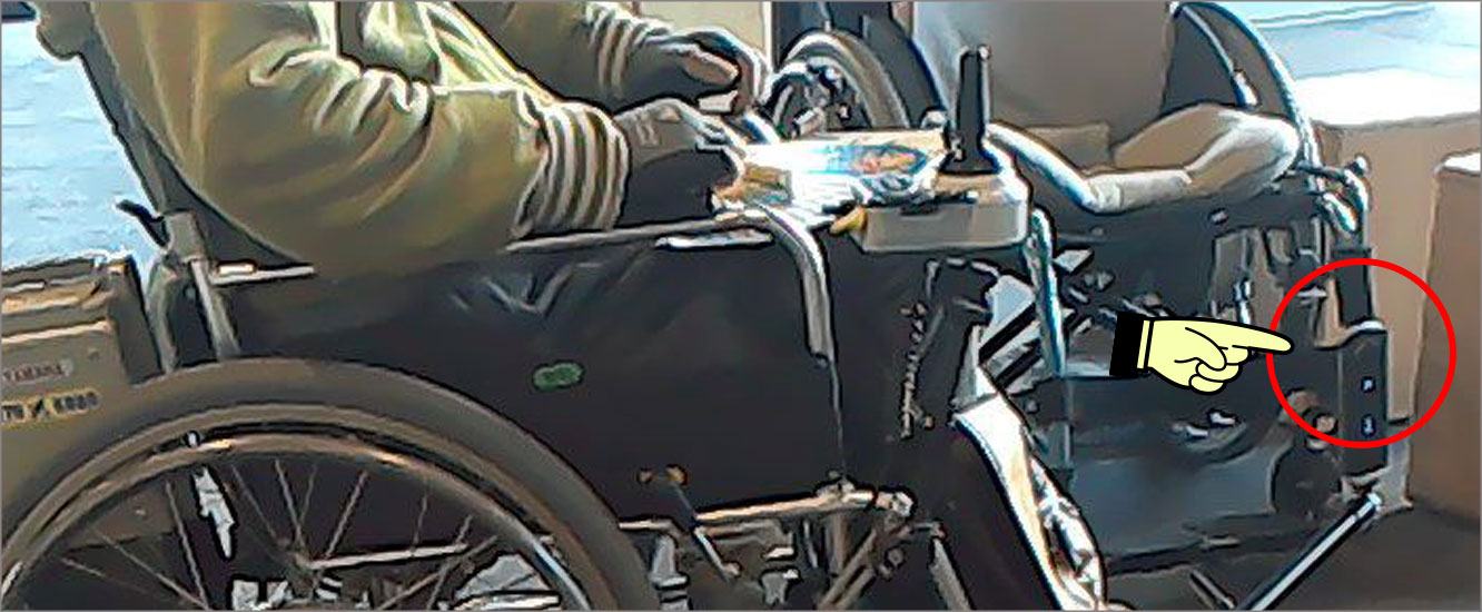
We have developed an application for measurement. When you install this application on the smartphone and the measuring camera, We cooperate with the wheelchair user, each user wears it on your wheelchair, we actually go to each spot and measure it.
Traffic support map for people with disabilities (PDF version)